
Base Line Survey
- Home
- Base Line Survey
Base Line Survey
What is a Base Line Survey?
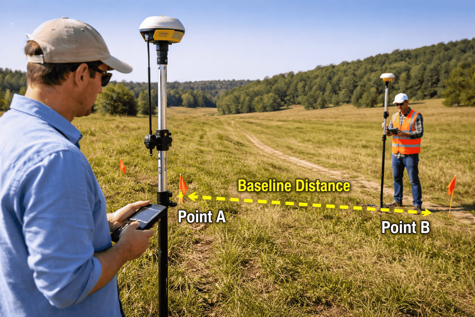
A base line survey involves establishing a straight reference line (baseline) across a survey area. This line is carefully measured and used as the primary reference for all other measurements and calculations.
The baseline acts as the backbone of the survey, from which distances, angles, and positions of other points are determined.
Purpose of a Base Line Survey
The main objectives of a baseline survey include:
- Providing a fixed reference for measurements
- Ensuring accuracy in mapping and layout
- Supporting triangulation and other survey methods
- Reducing cumulative measurement errors
- Establishing control points for the entire project
Where is Base Line Survey Used?
Baseline surveys are widely used in:
1. Land Surveying
Helps create accurate maps and property boundaries.
2. Construction Projects
Used for setting out buildings, roads, and infrastructure.
3. Topographic Surveys
Acts as a control line for mapping terrain features.
4. Engineering Projects
Supports precise alignment in large-scale developments like highways and railways.
Methods of Conducting a Base Line Survey
Direct Measurement
Using measuring tapes or electronic distance measurement (EDM) devices to measure the baseline accurately.
Triangulation Method
The baseline is used to form triangles across the survey area, allowing accurate calculation of positions.
GPS/GNSS Method
Modern surveys use satellite-based systems to establish highly accurate baselines over long distances.
Equipment Used in Base Line Survey
- Measuring tape or chain
- Total station
- Electronic Distance Measurement (EDM) devices
- GPS/GNSS receivers
- Survey markers and pegs
Importance of Accuracy in Base Line Survey
Since all other measurements depend on the baseline, even a small error can affect the entire survey. Therefore:
- The baseline must be measured with high precision
- It should be placed on relatively level and accessible ground
- Corrections for temperature, slope, and tension should be applied
Advantages of Base Line Survey
- Provides a strong reference framework
- Improves overall survey accuracy
- Simplifies calculations and mapping
- Essential for large and complex projects
Challenges in Base Line Survey
- Selecting a suitable location for the baseline
- Environmental factors like terrain and weather
- Measurement errors due to equipment or human factors
- Maintaining straightness over long distances
Best Practices for Base Line Survey
- Choose a clear and obstruction-free path
- Use high-precision instruments
- Double-check measurements and apply necessary corrections
- Establish permanent reference markers
- Integrate with modern surveying technologies
Conclusion
A base line survey is the starting point of many surveying operations. By establishing a reliable reference line, it ensures that all subsequent measurements are accurate and consistent.
In modern surveying, combining traditional baseline methods with advanced technologies like GNSS and total stations has significantly improved efficiency and precision—making baseline surveys an essential part of successful engineering and mapping projects.