
Hydrographic Survey
- Home
- Hydrographic Survey
Hydrographic Survey
What is a Hydrographic Survey?
A hydrographic survey is the process of measuring and mapping physical features of water bodies such as oceans, rivers, lakes, and coastal areas. It focuses on collecting data about:
- Water depth (bathymetry)
- Seafloor or riverbed shape
- Tides and currents
- Shoreline features
- Submerged objects and hazards
The collected data is used to create nautical charts, support engineering projects, and improve marine safety.
Key Components of a Hydrographic Survey
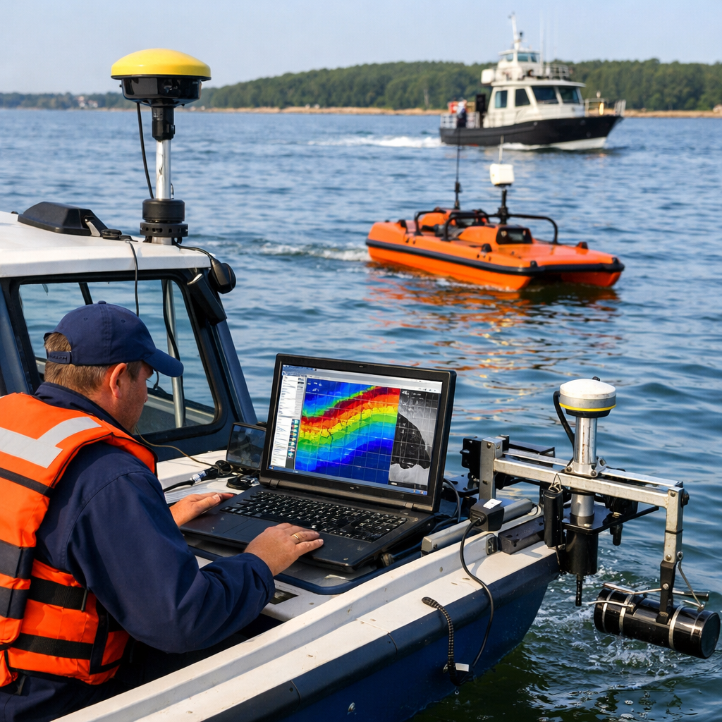
1. Bathymetric Survey
Measures water depth and underwater topography. This is the core part of any hydrographic survey.
2. Seabed Mapping
Identifies features such as rocks, sand waves, and wrecks using sonar technologies.
3. Tidal Observation
Records water level changes over time, which is essential for accurate depth measurements.
4. Current Measurement
Analyzes the speed and direction of water flow, important for navigation and construction.
Methods and Equipment Used
Modern hydrographic surveys rely on advanced tools and technologies:
Single Beam Echo Sounder (SBES)
Measures depth directly beneath the survey vessel. It is simple and cost-effective.
Multibeam Echo Sounder (MBES)
Captures detailed, wide-area bathymetric data, producing high-resolution maps of the seafloor.
Side Scan Sonar
Creates detailed images of the seabed, useful for detecting objects and textures.
GPS and GNSS Systems
Provide accurate positioning data for mapping and navigation.
LiDAR (Light Detection and Ranging)
Used in shallow waters and coastal zones to collect elevation and depth data from the air.
Applications of Hydrographic Surveys
1. Navigation Safety
Hydrographic data is used to produce nautical charts, helping ships avoid hazards and navigate safely.
2. Port and Harbor Development
Supports dredging, construction, and maintenance of ports and harbors.
3. Offshore Construction
Essential for installing pipelines, cables, wind farms, and oil platforms.
4. Environmental Monitoring
Helps study sediment movement, erosion, and marine habitats.
5. Disaster Management
Used to assess flood risks, coastal changes, and post-disaster conditions.
Importance of Hydrographic Surveys
- Ensures safe marine navigation
- Supports infrastructure development
- Helps protect marine ecosystems
- Enables accurate mapping of underwater terrain
- Reduces risks in offshore operations
Challenges in Hydrographic Surveys
- Harsh weather and sea conditions
- Equipment and operational costs
- Data processing complexity
- Need for skilled professionals
Future of Hydrographic Surveys
With advancements in technology, hydrographic surveys are becoming more efficient and precise. Innovations such as:
- Autonomous survey vessels
- AI-based data processing
- Real-time data transmission
- Satellite-derived bathymetry
Conclusion
A hydrographic survey is a vital tool for exploring and managing water environments. Whether for navigation, construction, or environmental protection, it provides the data needed to make informed decisions.
As global demand for marine resources and infrastructure grows, hydrographic surveys will continue to play a key role in shaping safe, sustainable, and efficient use of our water bodies.