
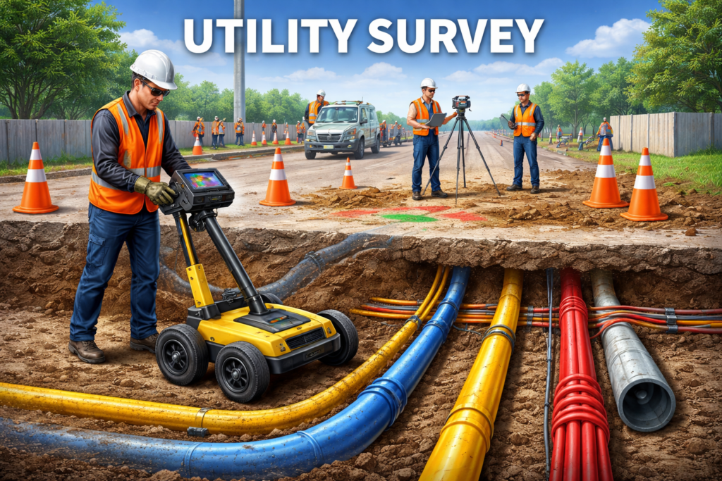
Utility Survey: A Complete Guide to Mapping Underground Services
Traffic Survey: A Complete Guide to Understanding Road Usage

Efficient transportation systems are the backbone of modern cities. Whether it’s reducing congestion, planning new roads, or improving safety, accurate data is essential—and that’s where a traffic survey comes in. A traffic survey is a systematic method of collecting data about vehicles, pedestrians, and overall road usage. This information helps engineers, planners, and policymakers make […]
Side Scan Survey: A Complete Guide to Mapping the Seafloor
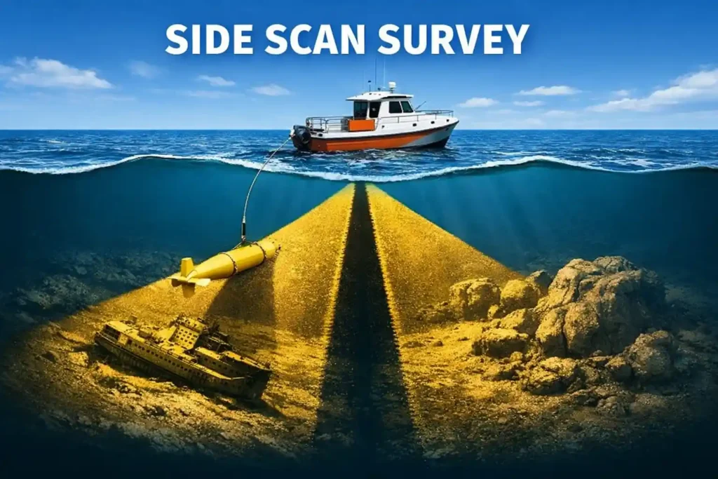
Understanding what lies beneath the water’s surface is crucial for industries like marine construction, offshore energy, environmental research, and archaeology. One of the most effective tools for this purpose is the side scan survey. This technology provides detailed images of the seafloor, helping professionals detect objects, map terrain, and make informed decisions.
What is a GIS Survey, and Why Does It Matter?

From urban planners routing new metro lines to disaster-relief teams tracking flood zones in real time, Geographic Information Systems (GIS) surveys have quietly become one of the most indispensable tools of the modern world. Yet for many, the term still draws a blank. Let’s change that.